 Ellicott — Deed Plotter · Sample deed Ellicott — Deed Plotter · Sample deed
A demonstration deed with fictional land, followed through the plotter step by step. Read it here, then try your own deed in a free account.
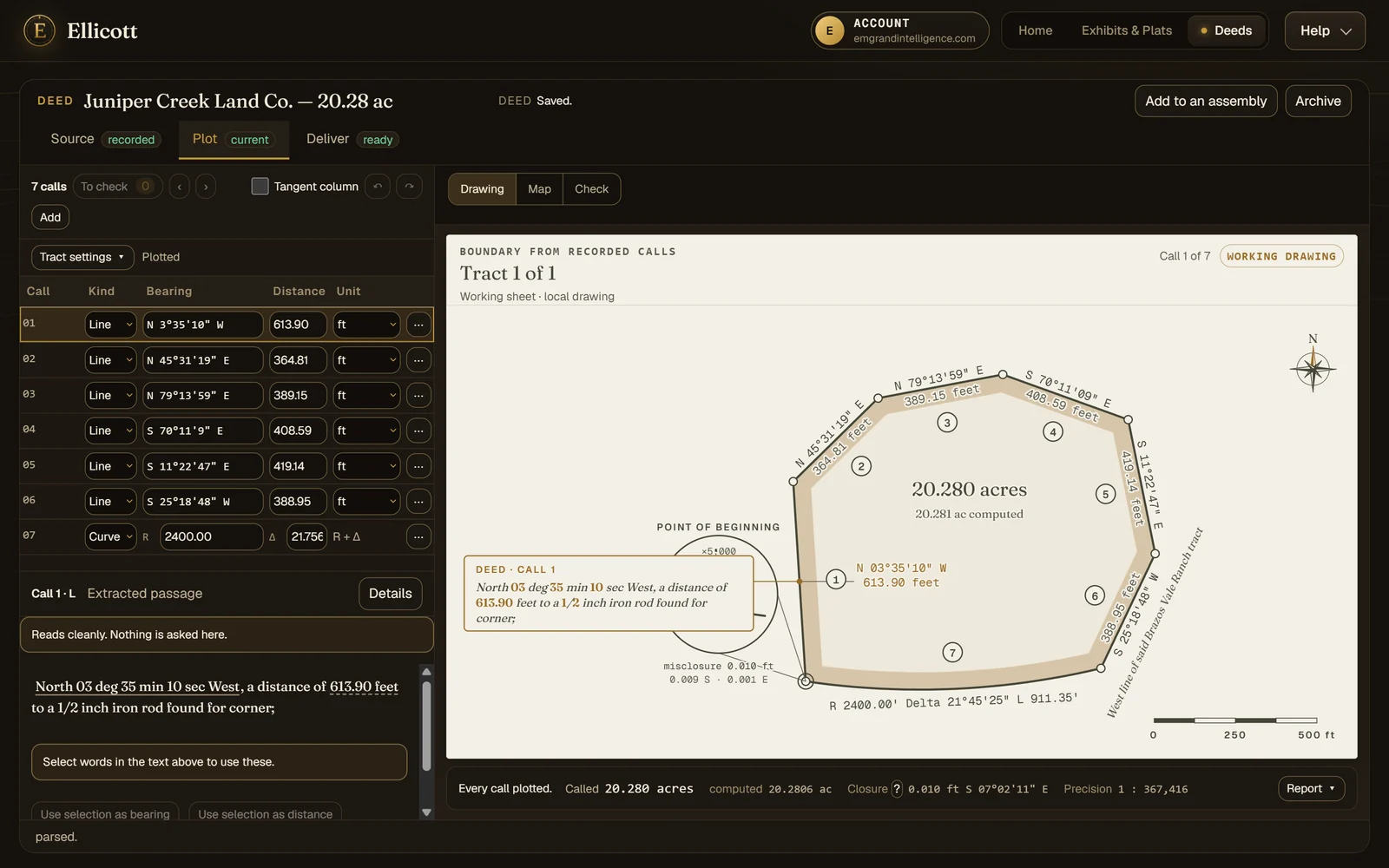
A demonstration deed: seven calls and a road-frontage curve, closing to 1 in 367,416.
Seven calls: six lines and a road-frontage curve, calling 20.28 acres. This is everything the plotter was given.
BEGINNING at a 1/2 inch iron rod found for the Southwest corner of the tract herein described;

THENCE North 03 deg 35 min 10 sec West, a distance of 613.90 feet to a 1/2 inch iron rod found for corner;

THENCE North 45 deg 31 min 19 sec East, a distance of 364.81 feet to a 1/2 inch iron rod found for corner;

THENCE North 79 deg 13 min 59 sec East, a distance of 389.15 feet to a 1/2 inch iron rod found for corner;

THENCE South 70 deg 11 min 09 sec East, a distance of 408.59 feet to a 1/2 inch iron rod found for corner;

THENCE South 11 deg 22 min 47 sec East, a distance of 419.14 feet to a 1/2 inch iron rod found for corner;

THENCE South 25 deg 18 min 48 sec West, a distance of 388.94 feet to a 1/2 inch iron rod found for corner;

THENCE along a curve to the right having a radius of 2400.00 feet, a central angle of 21 deg 45 min 25 sec, an arc length of 911.35 feet, and a chord which bears South 87 deg 28 min 11 sec West, 905.88 feet, to the POINT OF BEGINNING, containing 20.28 acres of land, more or less.
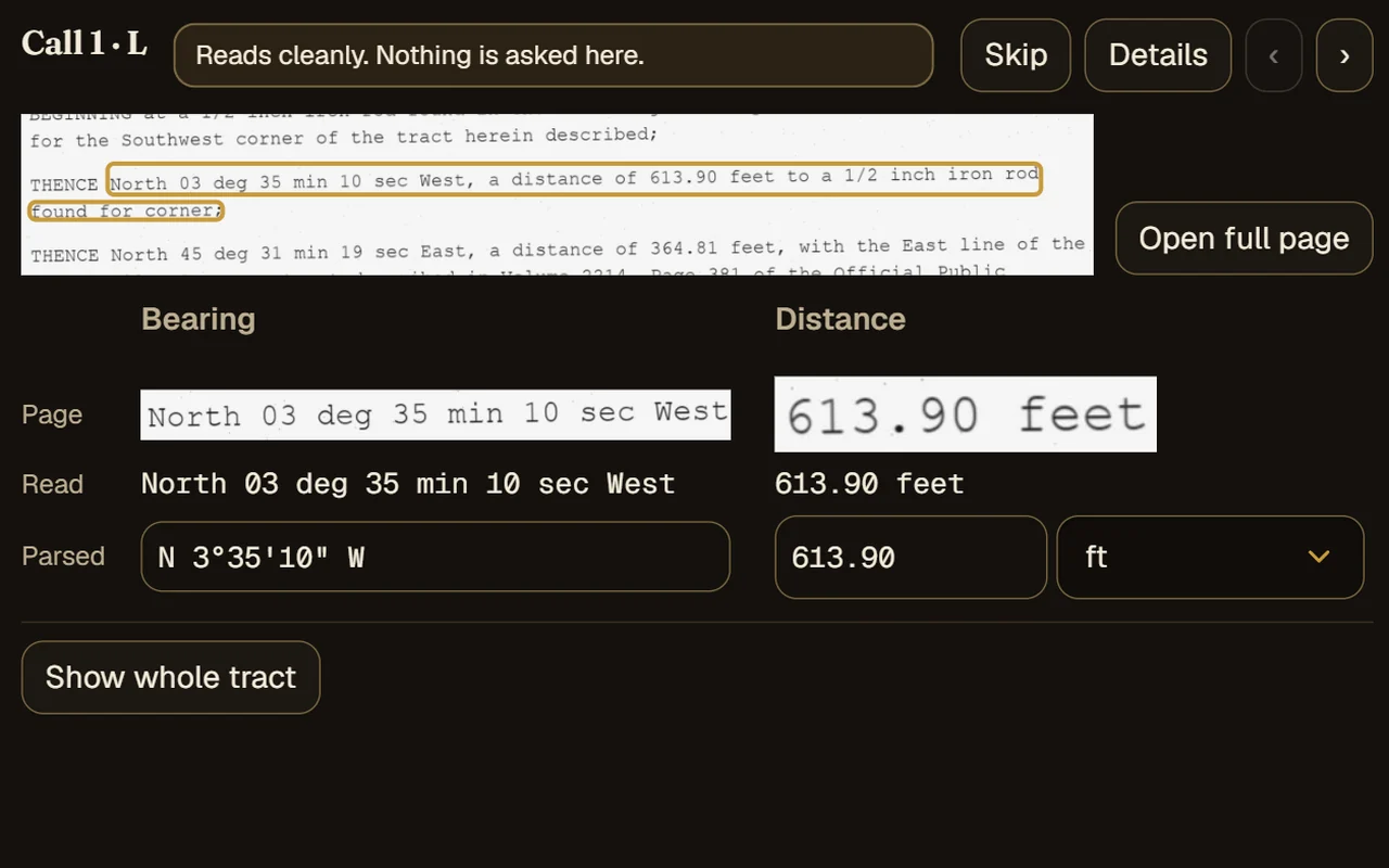
Drop in whatever the courthouse gave you. Scans and photos are read on our servers into a call table. For a scanned page, the Check view puts the page itself beside what was read and the value it became, so a misread is something you see rather than something you trust. A clean description often plots on the first read. A harder one stops at the call that needs you and says why, rather than drawing a guess.
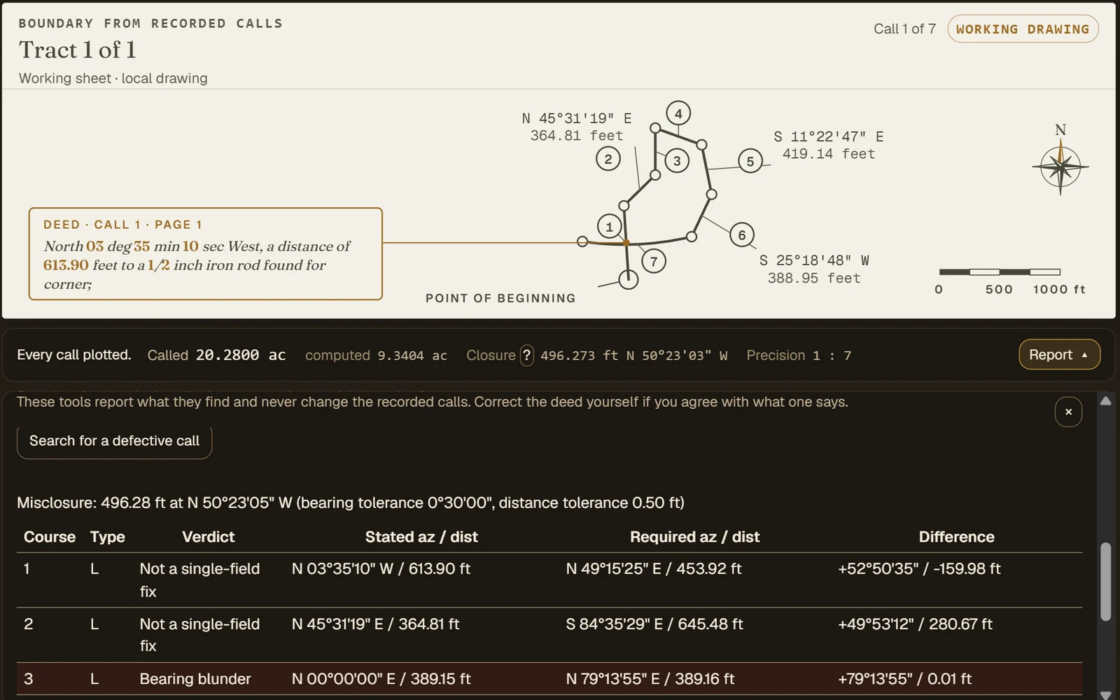
Closure error and direction, the precision ratio and the computed area against the deed's own acreage sit under the drawing the whole time. When a figure misses, the defective-call search looks for the single call whose bearing or distance would close it, and shows what that call would have to be. Not every deed closes as written: when no single call explains the miss, Ellicott says so and leaves the figure as the deed describes it, rather than forcing it shut. It reports; your calls only change when you change them. The Check tab compares each call with its page; the adjustments, ground-to-grid and defective-call search are under Report.
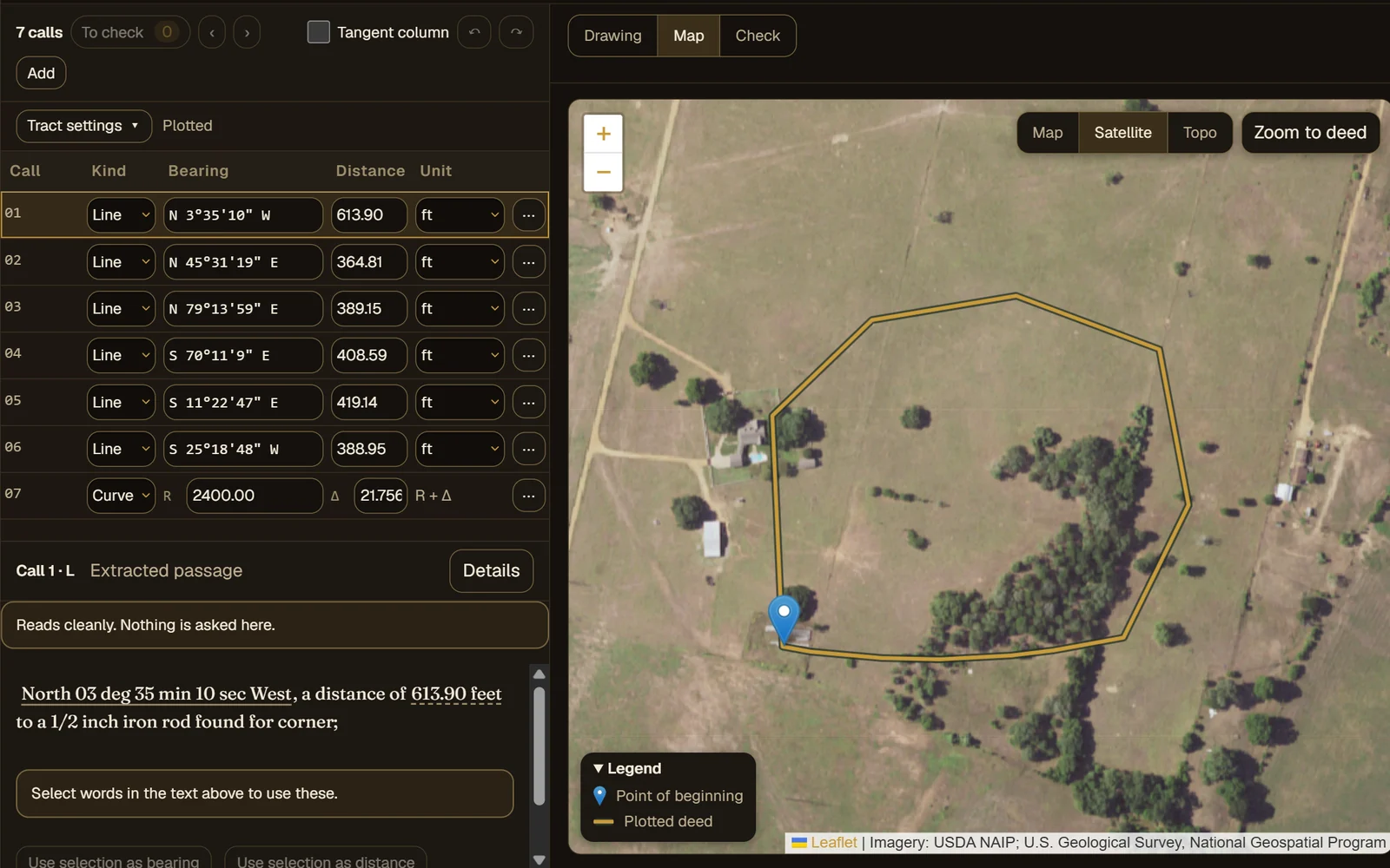
Set the point of beginning by clicking the map, typing coordinates, or taking the coordinates the deed itself states. Ellicott reads the county, survey and abstract out of the text to take you to the right place, then draws the tract in its state plane zone over aerial imagery.
See where it closes, and where it doesn't. No install, and your first export is free.