
Ellicott · Legal Exhibits

Every tract on the route, in hours, not months.

Upload the parcel and easement delivery your project already has. Ellicott checks it, then drafts an exhibit and its legal description for every tract in one run, with every measurement computed from your geometry rather than retyped. Ready for your surveyor's review, with nothing to install.

Open now Free accounts upload and preview any project. Exhibit production comes with a paid plan.
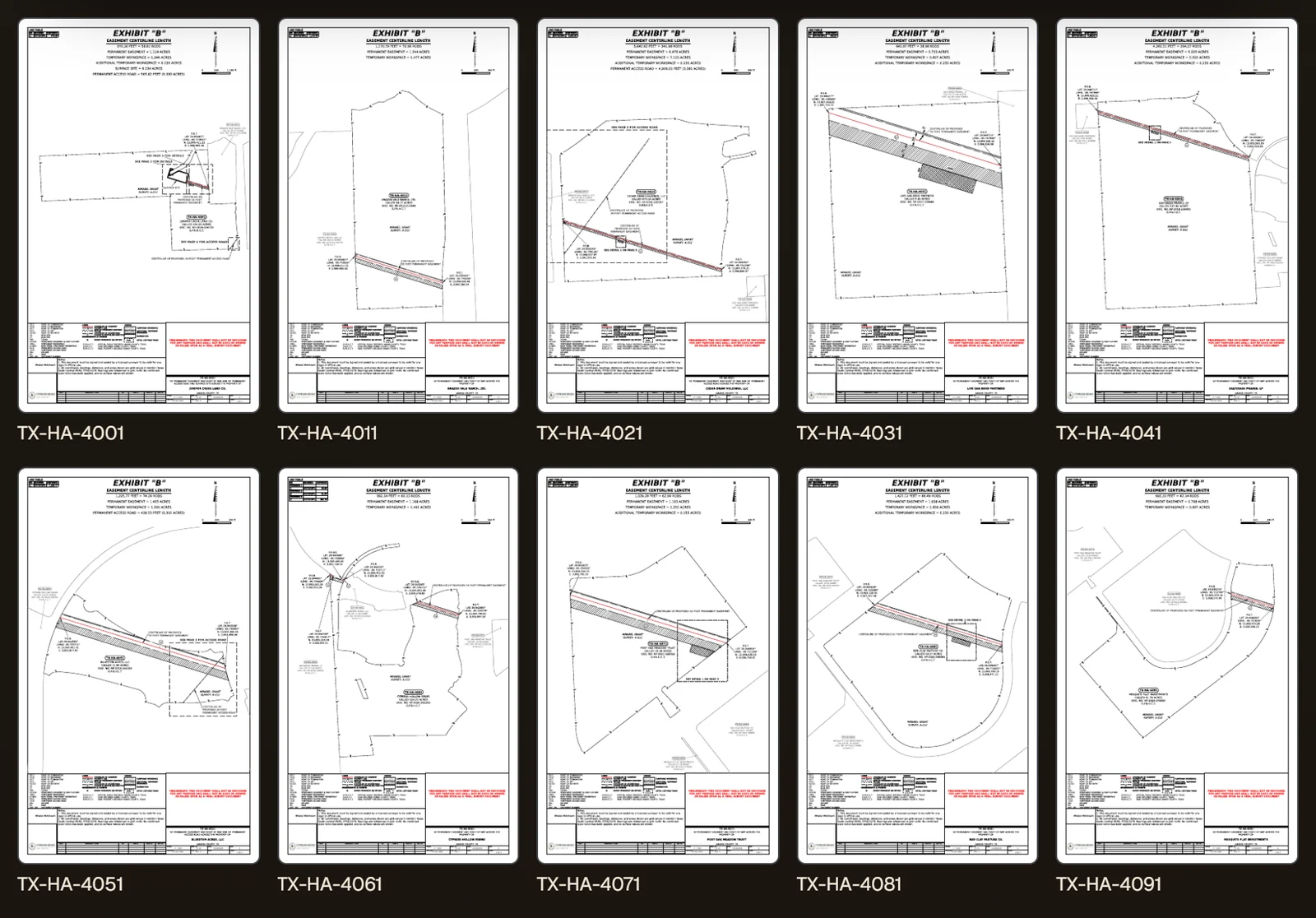
A finished demonstration delivery: an exhibit sheet for each tract on the route, each labelled with its tract number.

A demonstration pipeline delivery: one finished sheet per tract.

Legal Exhibits · 90 seconds

Hundreds of tracts. Hours, not months.

A pipeline delivery checked and run in one go: a finished sheet and its legal description for every tract, each measurement computed from the geometry, then the whole package on its way to the client.

Demonstration data with fictional names. Customer figures are anonymized and rounded. Exhibits are drafts for review, signature and seal by a licensed surveyor.
Time saved

Hours, not months.

Drafted by hand, a route's exhibits come one sheet at a time, and a long route takes months. Ellicott draws every tract in a single run, so the whole set comes back in hours and the surveyor's time goes on review instead of drafting.

70+

tracts on a single customer route, drawn and delivered in one run.

< 1 hr

from upload to finished exhibits on those routes, a sheet and a legal description for every tract.

Hundreds

of tracts is what a single run is built for, so a long route comes back in hours rather than months.

Customer figures are anonymized and rounded, from routes delivered in production.

How it works

Upload. Check. Preview. Deliver.

Each step shows you what Ellicott found before anything is drawn or billed: the layers it matched, the warnings it raised, and sample sheets from your own data.

01 · Upload

Start from the delivery you already have.

Send the GIS delivery the project already produces, with its parcel boundaries and construction footprints. Add a line list, and its owners, deed references and survey details are joined onto each parcel, so nobody retypes them onto a sheet.
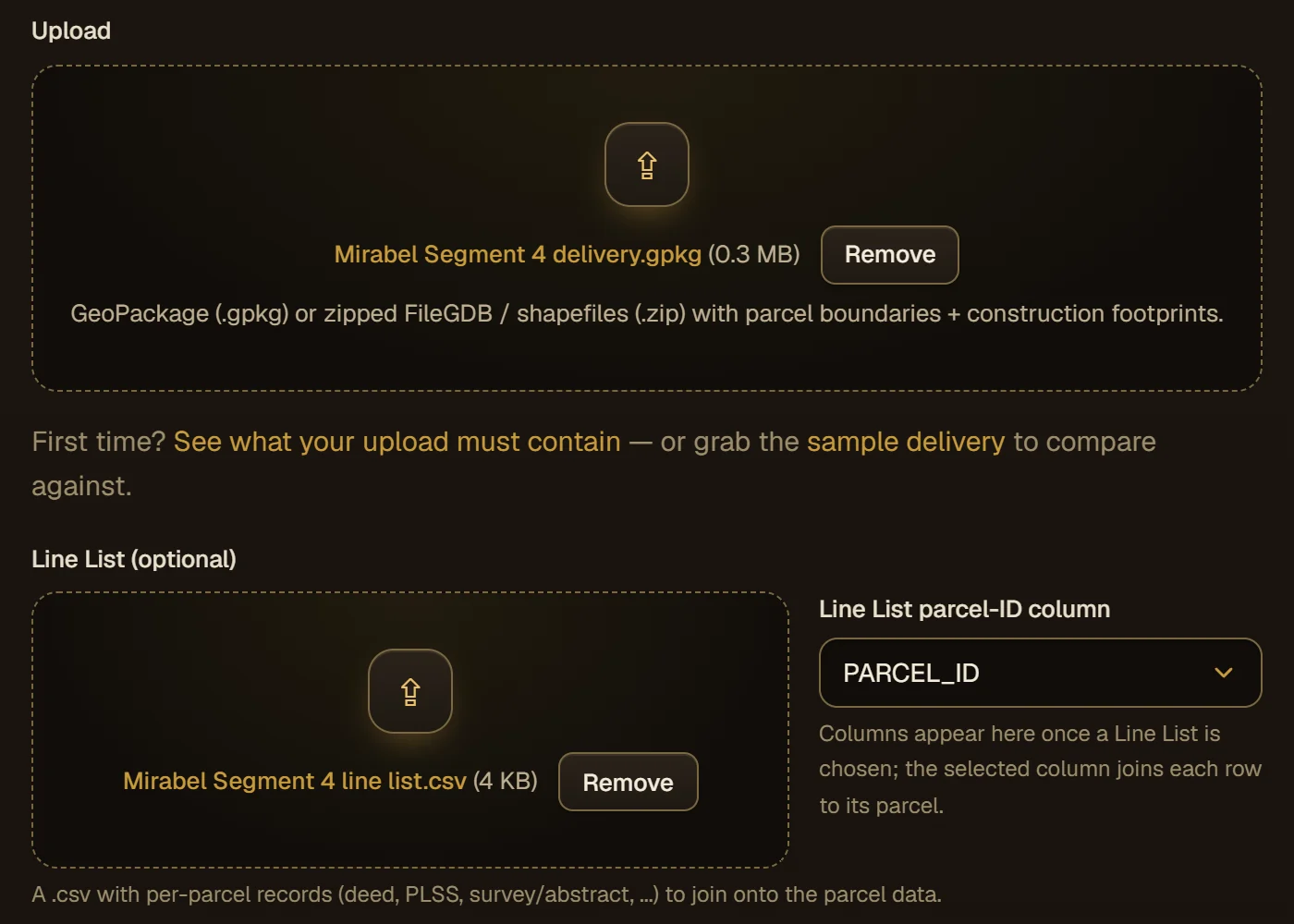
  • A GeoPackage, or a zip of a File Geodatabase or shapefiles
  • A CSV line list, joined to the parcels on the column you choose
  • A sample delivery to compare yours against
The upload step with a demonstration GeoPackage and line list attached, and the line list's parcel identifier column chosen.
02 · Check

Problems found before the drawing starts.

A delivery scorecard tests the data before a single sheet is drawn and says in plain language what it found: whether the centerline sits in the middle of the easement, whether the footprint widths hold along the route, whether the geometry is valid and the parcels overlap. Nothing blocks the run, but you see every warning first.
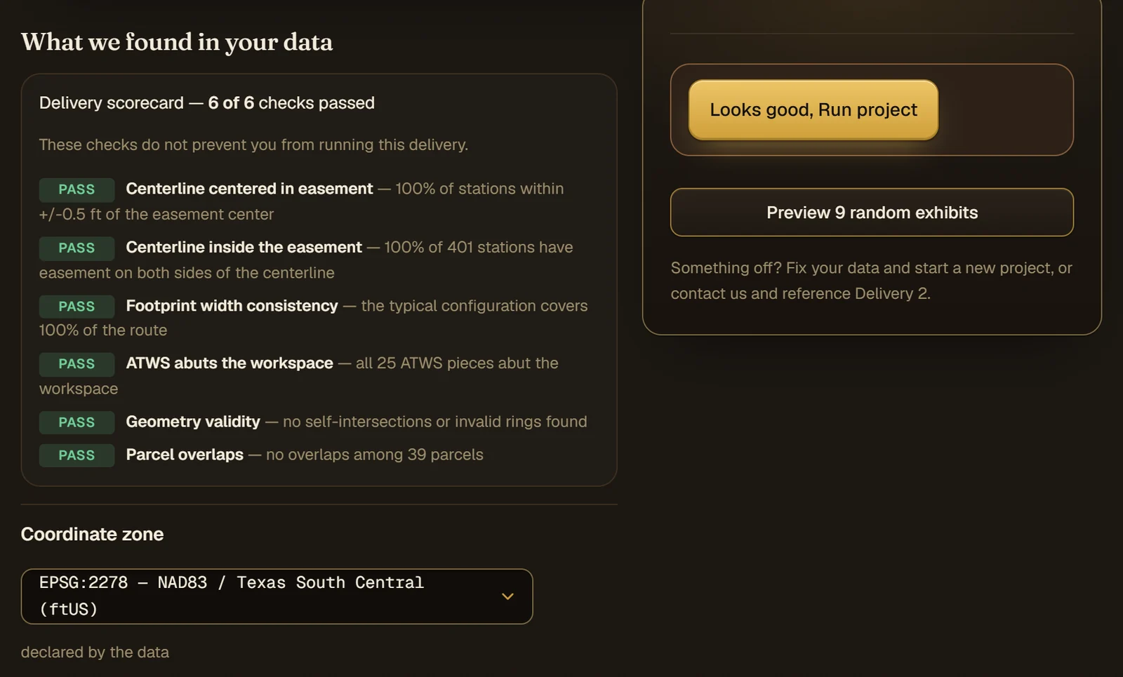
  • The coordinate zone read from the data, and yours to change
  • The route shown on a map, so you can see it landed where it should
  • The parcel identifier field confirmed by you
The delivery scorecard for a demonstration pipeline with every check passed, and the coordinate zone read from the data below it.
03 · Match

Every layer matched to what it is.

Ellicott sorts the delivery's layers into centerline, permanent easement, temporary and additional workspace, access roads and surface sites, and draws the typical construction configuration it read off the route, so you can confirm each area will be labelled for what it is.
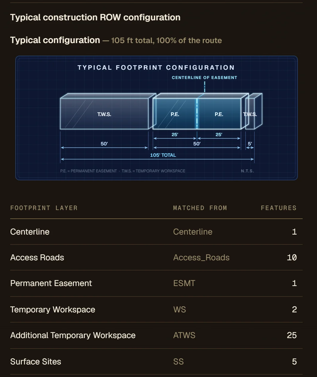
  • Each match shown with the layer it came from
  • The typical right-of-way configuration and its widths, drawn for you to check
  • Access road widths asked for when the data leaves them out, never guessed
Layer matching for a demonstration delivery: the typical footprint configuration with its widths, and each footprint layer beside the layer it was matched from.
04 · Title block

Your title block, set once.

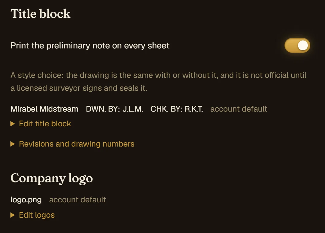
Set the drafting and checking initials, revisions and drawing numbers once, and every sheet in the run carries them. Owners, deed references and survey names come from your line list, the same way on every tract.
  • Your client's logo on the sheet, on paid plans
  • A preliminary note on every sheet, if you want one
  • A long tract drawn whole, or with its empty tail cropped
Title block settings for a demonstration account: the preliminary note switched on, the drafting and checking initials, and the company logo.
05 · Preview

See sample sheets before you commit.

Preview a sample of real sheets, drawn from your own data, before the full run. Previews are watermarked and stay in the app. When they look right, every tract is drawn in one run, with its progress shown as it goes and an email when it finishes, if you ask for one.
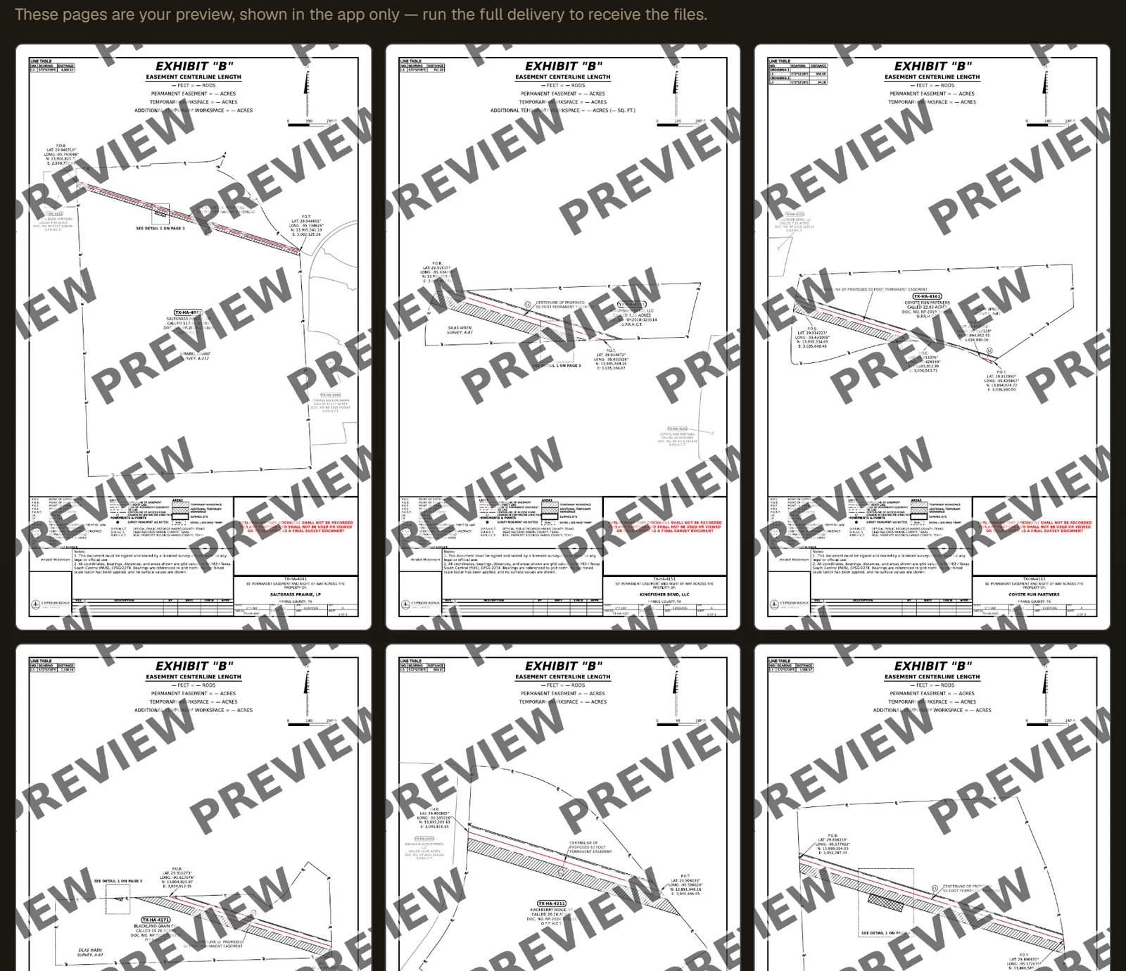
  • Previewing is free, on a free account too
  • See what was found, and the fee, before the full run starts
Watermarked preview sheets for a demonstration delivery, shown in the app before the full run.
06 · The sheet

A finished exhibit for every tract.

Each sheet carries the centerline length in feet and rods, the easement and workspace acreages, a line table of bearings and distances, a legend and your title block. Detail sheets are placed where a crossing is too tight to read.
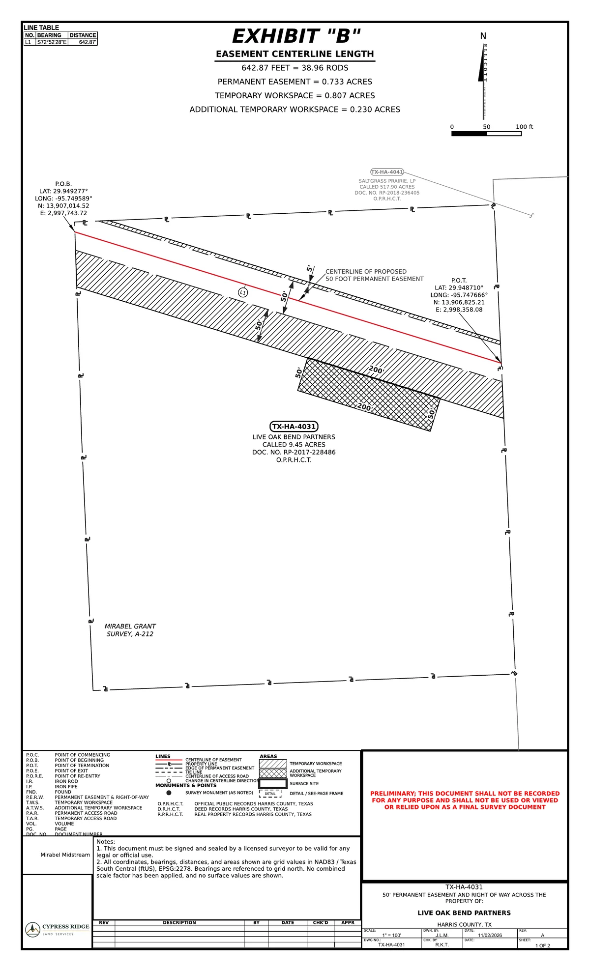
  • Permanent easement, temporary workspace and additional workspace, each computed per tract
  • Neighboring tracts labelled with their owners and recording references
A demonstration exhibit sheet for one tract: the easement strip across the parcel, the centerline length and acreages, coordinates at the points of beginning and termination, a line table, legend and title block.
07 · The description

The legal description, written from the same line.

Each tract gets a centerline legal description with every course, the length in feet and rods, and the easement and workspace areas, all taken from the geometry on the sheet.
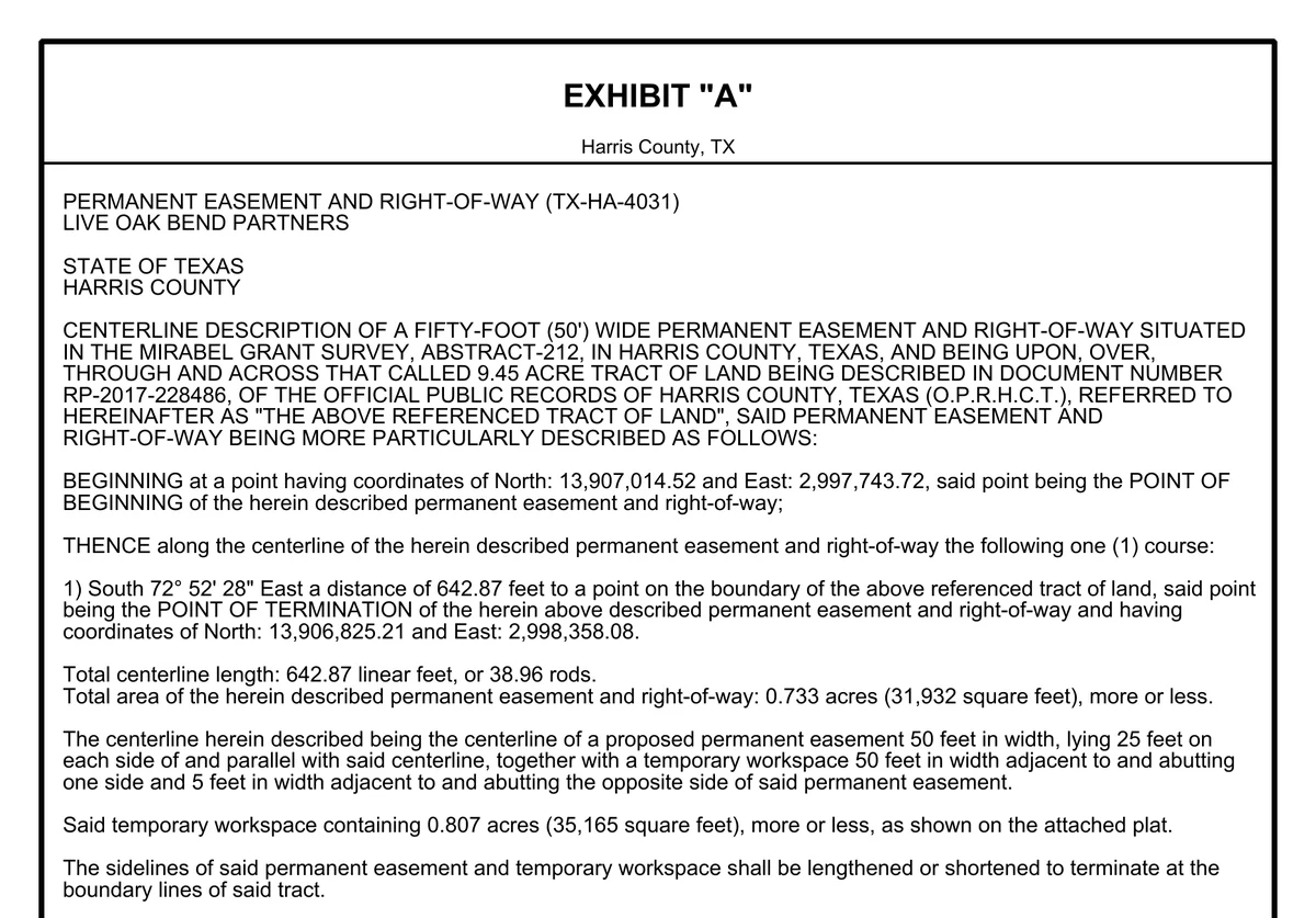
  • Survey, abstract and recording references carried from the parcel data and line list
  • The sheet, the description and the results table agree, because all three come from one boundary
  • Drafted for review by a licensed surveyor, who signs and seals it
The demonstration tract's centerline legal description for a fifty-foot permanent easement, with its point of beginning, course, point of termination, length and areas.
08 · Deliver

Download everything, or send your client a link.

When the run finishes, take the whole package in one download, or pick files tract by tract, grouped by location or by landowner. Or send the client a link to the delivery instead of an attachment.
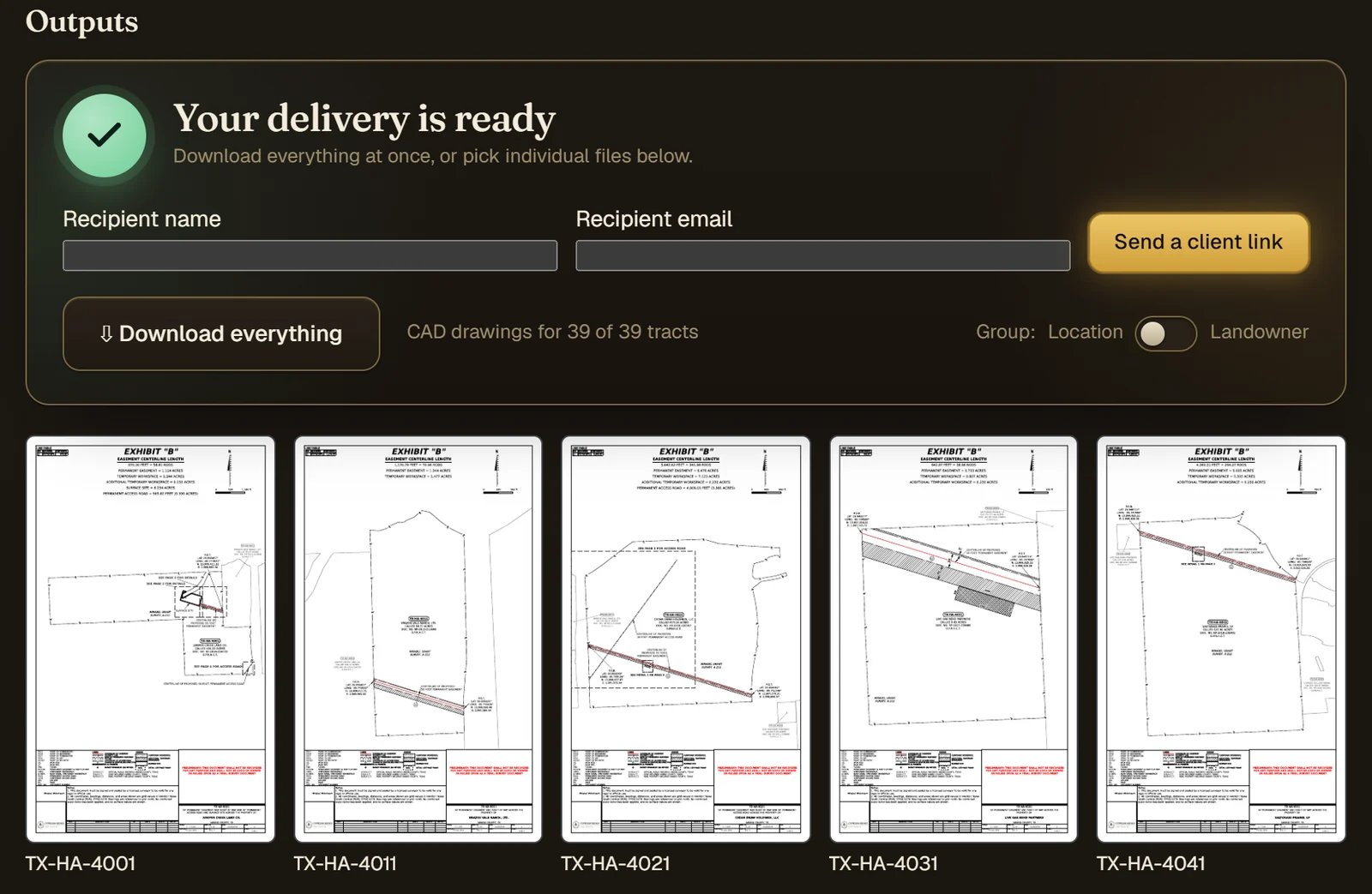
  • A PDF for every tract, with CAD, KMZ and shapefiles when you ask for them
  • A results table of every tract's areas and lengths
  • Running or downloading a delivered project again is free
A finished demonstration delivery: a download for the whole package, a form to send the client a link, and the exhibit sheet for each tract below.
Capabilities

The drafting a route needs, tract after tract.

The sheets a land team would otherwise draft one at a time, drawn the same way for every tract on the route and checked against the data they came from.

Input

  • GeoPackage, File Geodatabase or shapefiles
  • Parcel boundaries and construction footprints in one delivery
  • A CSV line list joined on a parcel identifier
  • Placed deeds promoted from the Deed Plotter when there is no parcel layer

Checks

  • Centerline inside the easement, and centered in it
  • Footprint widths consistent along the route
  • Additional workspace abutting the workspace
  • Geometry validity and parcel overlaps

The sheet

  • Easement and workspace acreages per tract
  • Centerline length in feet and rods
  • Line table, legend, north arrow and scale
  • Detail sheets where a crossing is too tight to read

Description

  • A legal description for every tract
  • Every course, the length and the areas, from the sheet's geometry

Output

  • PDF exhibits and a CSV results table with every run
  • DXF CAD package, KMZ and shapefiles as options
  • Files grouped by location or by landowner

Working together

  • Runs in any modern browser; no GIS license needed
  • Organization accounts, not machine-locked seats
  • A link that sends the delivery to your client
  • An email when a long run finishes
Principles

Built to be checked.

Every measurement computed, never retyped.

Bearings, distances and acreages are computed from your geometry, and the sheet, the description and the results table are all written from that one computation, so they agree figure for figure. Nothing is copied by hand from one to another, so nothing is mistyped on the way, and the delivery itself is checked before any of it is drawn.

A draft for your surveyor, not a substitute.

Exhibits are drafted for review by a licensed surveyor, who signs and seals them. They are drawn from the boundaries you supply, so they are only as sound as that data.

Pricing

Preview free. Pay when it delivers.

On a free account, uploading a delivery, checking it and previewing sheets cost nothing. Exhibit production comes with a paid plan, with a production fee per delivered exhibit. The pricing sheet has current prices.

  • 01 A free account Open now
  • 02 Upload, check and preview any project at no charge
  • 03 Deliver on a paid plan; running or downloading it again is free

See the pricing sheet →

Preview exhibits from your own delivery.

Upload a delivery and see sample sheets before you spend anything. No install.

Start free