 Ellicott — Mapping Intelligence Ellicott — Mapping Intelligence
Two tools for land teams, built on the same geometry. The Deed Plotter turns deed text into a closed, placed boundary. Legal Exhibits turns your parcel and easement delivery into a finished package for every parcel.
Coming soon Free accounts: everything short of export. See pricing for export options.
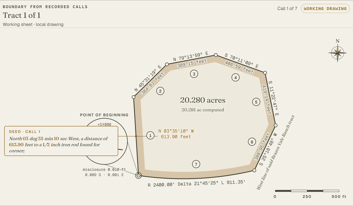
Read a scan, photo, Word file or pasted text. Check closure and area, place it on aerial imagery, and assemble it with its neighbors.
Explore the Deed Plotter →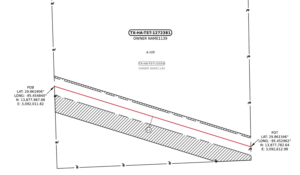
Upload the GIS delivery you already have. Ellicott checks it, then draws an exhibit for each affected parcel, with CAD, KMZ and shapefiles alongside.
See Legal Exhibits →One delivery in, a complete package out, with a checkpoint in the middle so nothing is drawn against data you haven't seen first.
A GeoPackage, or a zip of a File Geodatabase or shapefiles, with your parcels and easement footprints. Add a line list to carry deed and survey references onto each sheet.
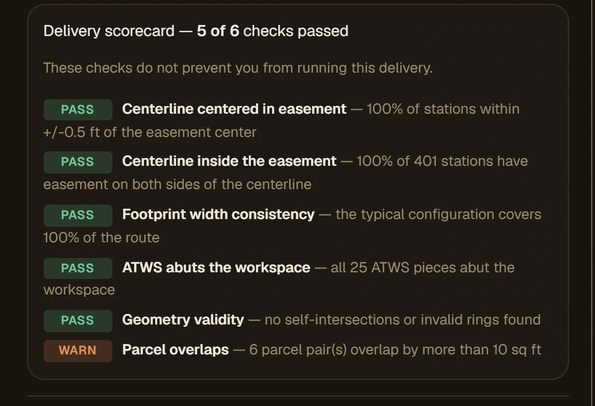
Ellicott finds the coordinate zone, layers and parcel identifiers, then scores the delivery: centerline inside the easement, footprint widths, geometry validity, parcel overlaps.
You see exactly what was found, and the estimated fee, before processing starts. Preview sample sheets free first if you want to.
An exhibit for every affected parcel, the acreage and length table, and the GIS and CAD files you asked for.
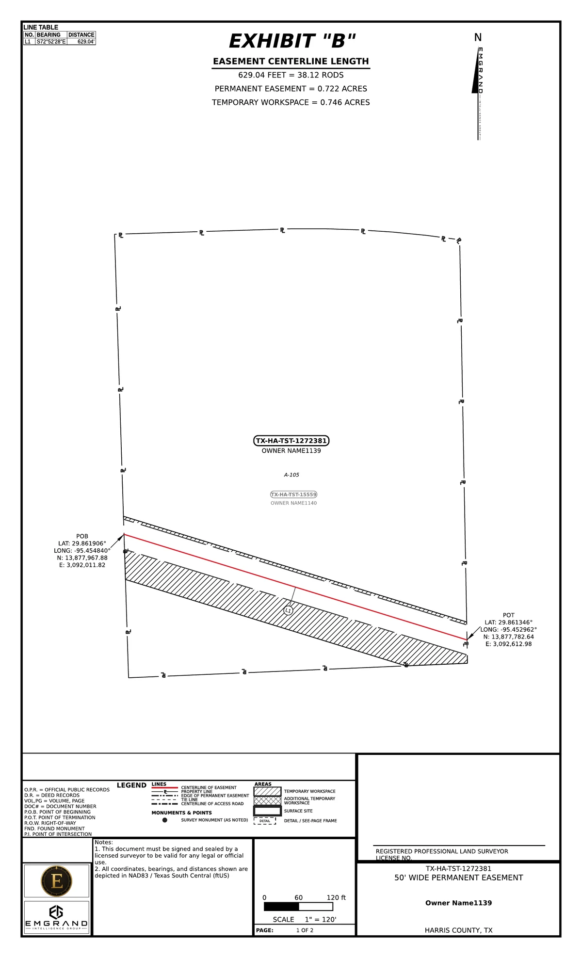
Each sheet carries the easement and workspace areas, the centerline length in feet and rods, a line table, crossings and detail frames where the geometry needs them. Legal Exhibits add a metes-and-bounds description written from the same boundary.
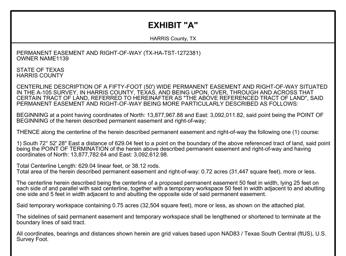
Each Legal Exhibit comes with its Exhibit A: a centerline description with the point of beginning and termination in grid coordinates, every course, the length in feet and rods, and the easement and workspace areas, all taken from the geometry on the sheet.
A delivery scorecard checks the data you sent before a single sheet is drawn, and says in plain language what it found. Nothing blocks the run, but you see every warning first.
When a client has no parcel layer, plot the deeds instead. A placed deed, or a whole assembly of adjoining deeds, promotes straight into a exhibit project as its parcels. Every output keeps the same geometry, so the table, the map layer and the sheet always agree.
CAD uploads (DWG or DXF) are not accepted yet; they're on the roadmap, not in the product.
PDFs and the results table come with every exhibit run; KMZ, shapefile and CAD files are per-run options. Deed exports are listed on the Deed Plotter page.
A deed call points to the words it was read from; an exhibit's acreage comes from the same boundary the sheet draws. Where the input is ambiguous, Ellicott says so rather than guessing.
Deeds are read by recognition software on our own servers, and are never sent to an AI model or an outside service to be read.
Plot deeds, or preview exhibits from your own data, at no charge. Until then, the pricing sheet has current prices and how to reach us.